
High Point Creek Mudslide (Redux)
Careful observers of Issaquah Creek have noticed a recurring syndrome – muddy water flowing in the East Fork every time there is a significant amount of rain. This is particularly noticeable at Confluence Park where the East Fork joins the main stream. The contrast between the muddy water and the clear water is striking, as shown in the photo below:

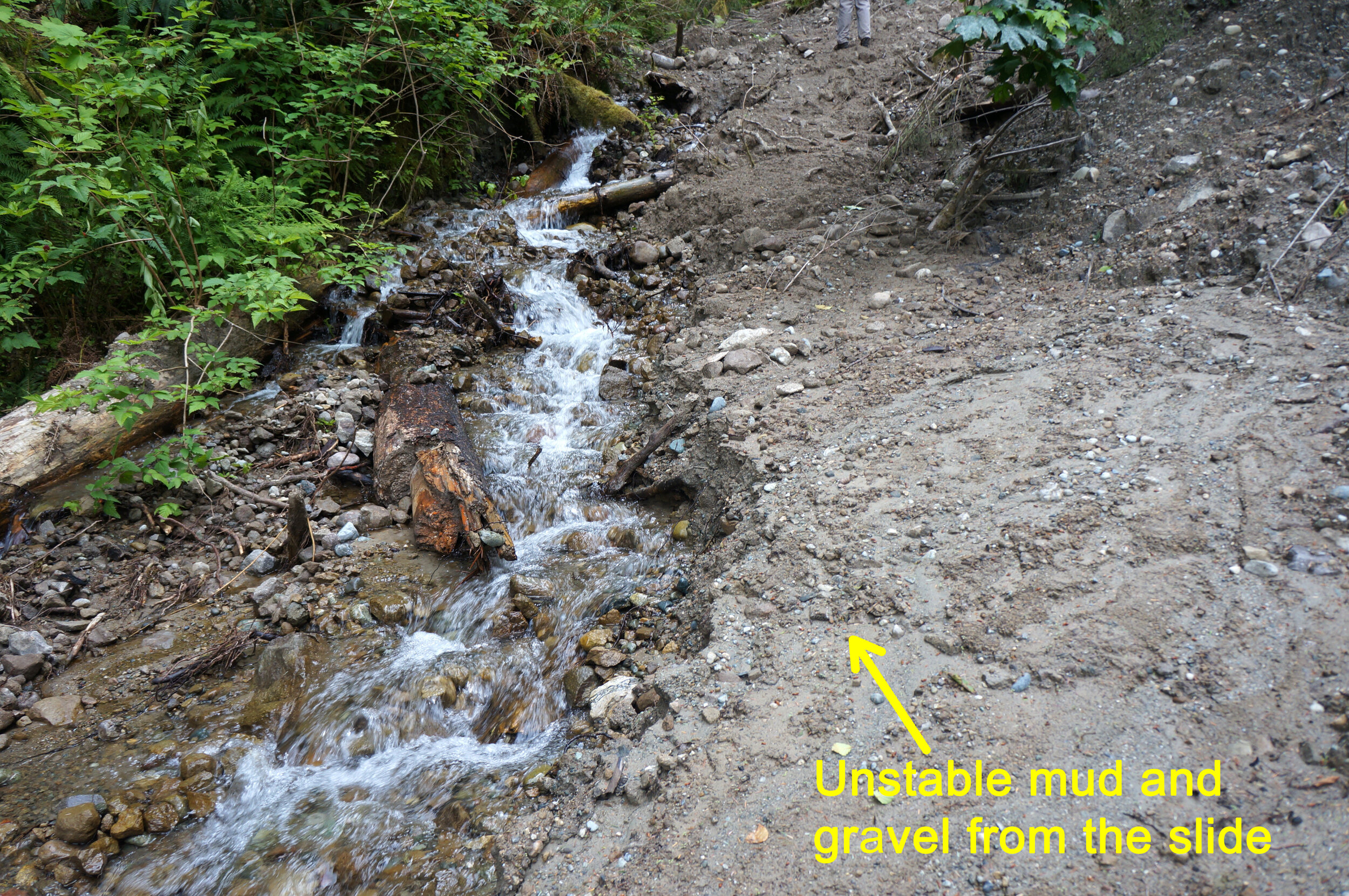
Investigation by our intrepid “watcher” David Kappler revealed the root of the problem – a mudslide along the banks of the High Point Creek at about 800 ft. elevation. A major creekside bank gave away, spilling tons of glacial till and mud into the path of the creek. The following photos illustrate:


A scar of this magnitude will not heal overnight, but the process is underway. The creek runs clear when we have a few days without rain, but when it does rain, flow through the slide rubble brings silt to the creek once again. The following photo illustrates how the mud flow comes right up to the edge of the creek:
The slide area is situated in the West Tiger Mountain Natural Resource Conservation Area, under the jurisdiction of the Washington State Department of Natural Resources. A DNR staff geologist has visited the site, but no remediation is planned at this time due to the remoteness of the site.
Mudslides are not new to the High Point Creek. A heavy rain in February of 1932 resulted in a debris dam forming upstream, and when the dam broke loose, a wall of water, mud and debris swept down to High Point taking with it a house, steam donkey and locomotive (belonging to the High Point Mill). The following photo from the Seattle PI captures the devastation:

Sleeping in the house were Mr. and Mrs. George Johnson and their four children. George and son, Gösta, sleeping on the first floor, were killed in the cataclysm. Two other children on the first floor, along with Mrs. Johnson and son, Knute, on the second floor, survived.
To put this flood in historical context, the High Point Mill had harvested all the trees it could from Tiger Mountain by the close of 1928. Thus, the slopes around the High Point Creek were denuded, leaving them vulnerable to erosive forces. The storm brought torrential rains and a warm Chinook wind melting the snow on the upper slopes of Tiger Mountain, a perfect combination leading to the destruction on that February night.
The debris flow crossed the main road through High Point (the Sunset Highway), thus disconnecting it from nearby Issaquah for several days. The storm also caused damage and loss of life throughout the region. The country in 1932 was the grip of The Great Depression, so some saw a silver lining in the form of public works jobs. Here is a little example of that sentiment from the Issaquah Press dated March 3, 1932:

Well, what can we learn from all this? Alas, the Great Depression is over, the High Point Mill is gone, but the forces of Nature remain.